STORY AND PHOTOS BY ALFRED SCHOTZ
Wildflower viewing in north Alabama
Springtime across north Alabama is a joyous season, one of celebrations and festivals heralding the arrival of a new year. As winter begins to loosen its grip, one of the region’s greatest natural splendors gradually unfolds – a kaleidoscope of colors paraded by vibrant displays of wildflowers.
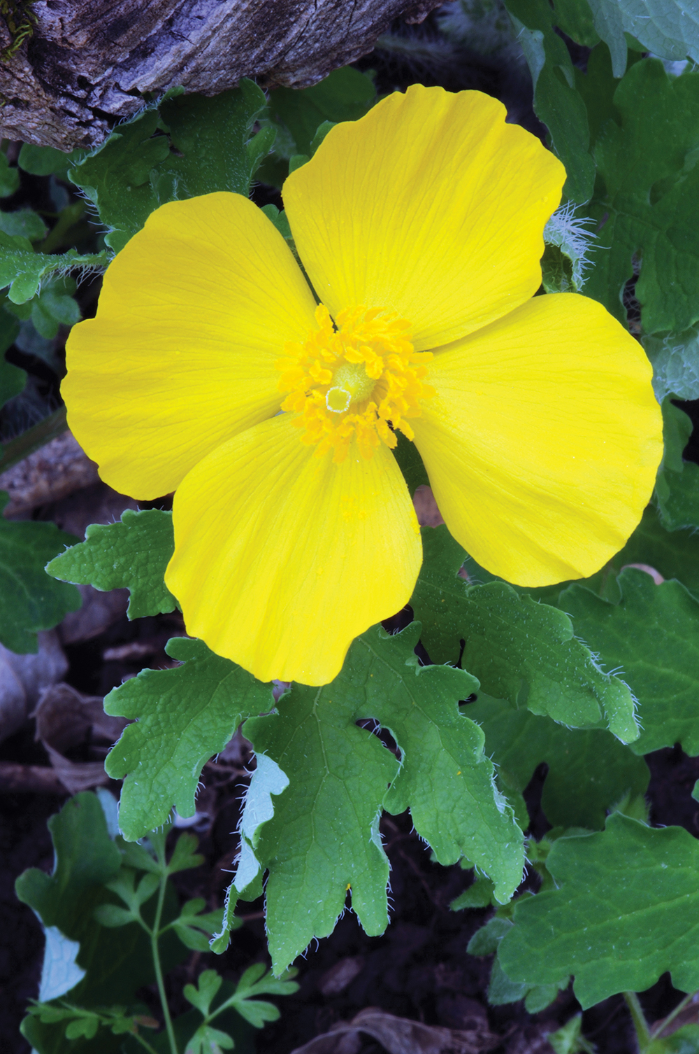
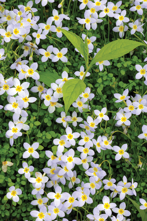
From the waning days of March through May, wildflowers of all shapes, sizes, and colors will vie for attention from those who want to witness their endless glory.
The rich and varied landscape that makes up the northern part of the state is home to a remarkable variety of wildflowers. In fact, the region’s unique mix of geology, topography, and soils has favored some of the most diverse and striking plant life anywhere across North America.
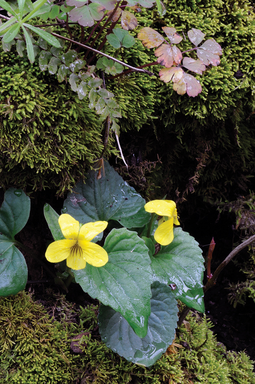
Limestone and soils derived from limestone are abundant, especially along major streams and lower slopes, and can help explain the story behind the profusion of wildflowers that debut every spring.
By its very nature, limestone is softer and can dissolve more quickly than most rock types, allowing greater amounts of nutrients essential for growth to become rapidly available. With this higher influx of nutrients comes a luxuriant and diverse array of wildflowers and other plant life.
In climbing upward to the high slopes and ridge tops of north Alabama’s loftiest elevations, one may detect a difference in the kind and number of wildflowers from those at lower altitudes. Covering the summits of Lookout, Sand, and other mountains in the region is a rock cap largely consisting of sandstone. Unlike limestone, sandstone is more resistant to the forces of nature, able to greatly withstand the rigors of wind and rain.
Such resistance imparts a profound influence on the variety and size of spring wildflower displays, where a slower rate of nutrients available for plant growth makes for smaller, less colorful displays.
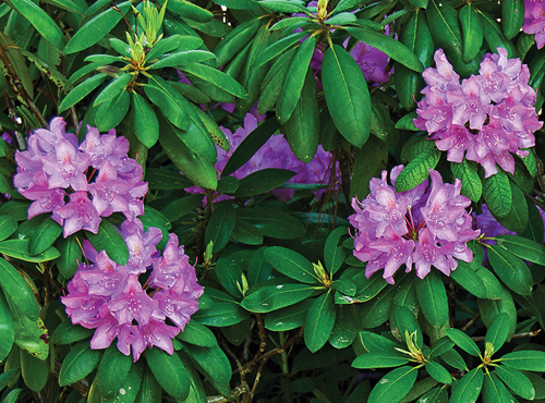
The true glory of the region’s mountain summits, however, comes into full view later in the season, the month of May across north Alabama, as a countless extravaganza of flowering shrubs begin to flaunt their grandeur. Mountain laurel, rhododendron, azaleas, fringetree, and farkleberry will not disappoint, gracing rocky ridges, streambanks, and pathways with a palette of color.
North Alabama abounds in numerous opportunities to know and appreciate the region’s wildflower bounty and rich botanical heritage. As spring evolves from the first woodland flowers to the festival of colors exhibited by rhododendron and mountain laurel in May, a multitude of footpaths will beckon the earnest daytime explorer.
A sample of options are offered here. Easily accessible public conservation areas offer trails to bring visitors up close for some of the finest wildflower viewing to be found anywhere in north Alabama.
In visiting the sites highlighted for this article, the visitor should be mindful of staying on trails to avoid trampling plants and most importantly, not to pick flowers so others can enjoy. To get the most from your visit, proper clothing and a camera will be invaluable, and depending on how long you plan to hike, be certain to have sufficient food and water on hand.
Alfred Schotz is a botanist with the Auburn University Museum of Natural History.
North Alabama wildflower trails
TVA Nature Trail Complex
How to get there: Accessible from a paved parking area on the south side of the Tennessee River on the eastern outskirts of Muscle Shoals. To reach the parking area, proceed east on Wilson Dam Highway roughly 1.5 miles from Woodward Avenue (U.S. Highway 43) in Muscle Shoals to Thunder Road. Turn left onto Thunder Road and continue 600 feet to the parking area. Three trails showcasing easy wildflower viewing are the Old Fort Trail, Old First Quarters Trail, and the Rockpile Trail.
Trail condition: Trail difficulty is easy, with some uphill walking for trails near the Tennessee River, specifically on return to the parking area.
Best time to visit: Late March – mid-April. Striking wildflower displays can be observed in short walking distances, with the most colorful on lower slopes nearest the Tennessee River.
 Thompson Creek Trail – Bankhead National Forest
How to get there: The trailhead is marked by a kiosk at the end of County Road 3 in the western portion of the Sipsey Wilderness, Bankhead National Forest. The parking area can only be reached by driving east on County Road 3 roughly 4 miles from Lawrence County Road 303, south of Mt. Hope.
Trail condition: The trail is rated as moderate, but is relatively level with a small number of gentle inclines and narrow stream crossings generally consisting of step-overs. The trail is roughly 6.5 miles long, returning to the parking area the same way going in.
Best time to visit: Late March – mid-April. A premier sites for spring wildflowers in north Alabama, the trail meanders along Thompson Creek, passing spectacular displays of early spring flora, impressive rock formations, and small waterfalls.
 Point Rock Trail – Bucks Pocket State Park
How to get there: Bucks Pocket State Park straddles the Jackson-DeKalb county line, and is easily reached by driving northeast from Guntersville or northwest from Geraldine on State Highway 227 following signs to the park entrance. The trail has two access points, one within the camping area (currently closed) and the other off County Road 556.
Trail condition: Trail difficulty is easy to moderate, becoming steeper near the summit of Sand Mountain at Point Rock. A trailhead also exists at the summit of Sand Mountain off County Road 556, allowing easy walking to the Point Rock overlook.
Best time to visit: Late March – mid-May. The portion of the trail nearest the camping area is situated in a sheltered valley, and is a favorite viewing spot for early spring wildflowers from late March to mid-April.
During early to mid-May, mountain laurel and purple rhododendron can be observed along the uppermost section at the summit of Sand Mountain in the vicinity of Point Rock, a scenic overlook off County Road 556.
 Little River Canyon National Preserve
How to get there: Preserve is on the summit of Lookout Mountain, roughly 7 miles east of Fort Payne off State Highway 35. Along Highway 176 between State Highway 35 in the north and the Canyon Mouth Picnic Area at the south, several options exist, either as short walks or quick stops at overlooks, for viewing some of the most stunning wildflower displays in the northern part of the state.
Trail condition: The Eberhart Point Trail into Little River Canyon is rated as moderate difficulty and upon returning to the canyon rim, will be the most strenuous of the trails suggested for viewing wildflowers in the Preserve.
Best time to visit: Mid-April – late May. Mountain laurel, azalea, rhododendron, and fringetree are in full splendor throughout May with Eberhart Point Overlook, and the Beaver Pond and Little Falls Trails having some of the finest displays. Pageants of wildflowers can be viewed at several places along Highway 176, with some of the best and easily accessed being the Lynn Overlook, the Beaver Pond Trail, and the Eberhart Point Trail.